- Komang Kharak Dolpo
- Himalayan Dolpo Region
Komang Kharak Dolpo
Geographical location
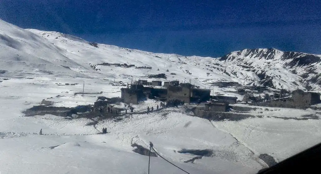
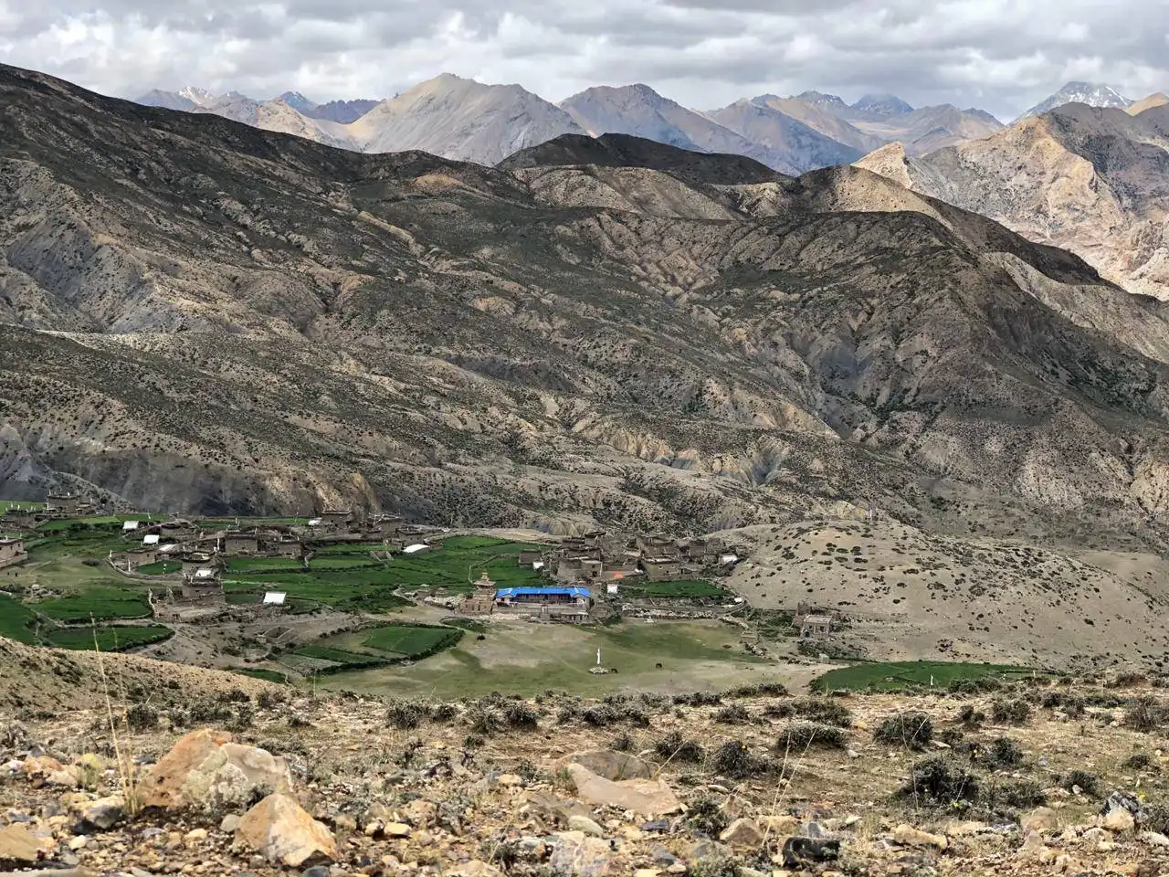
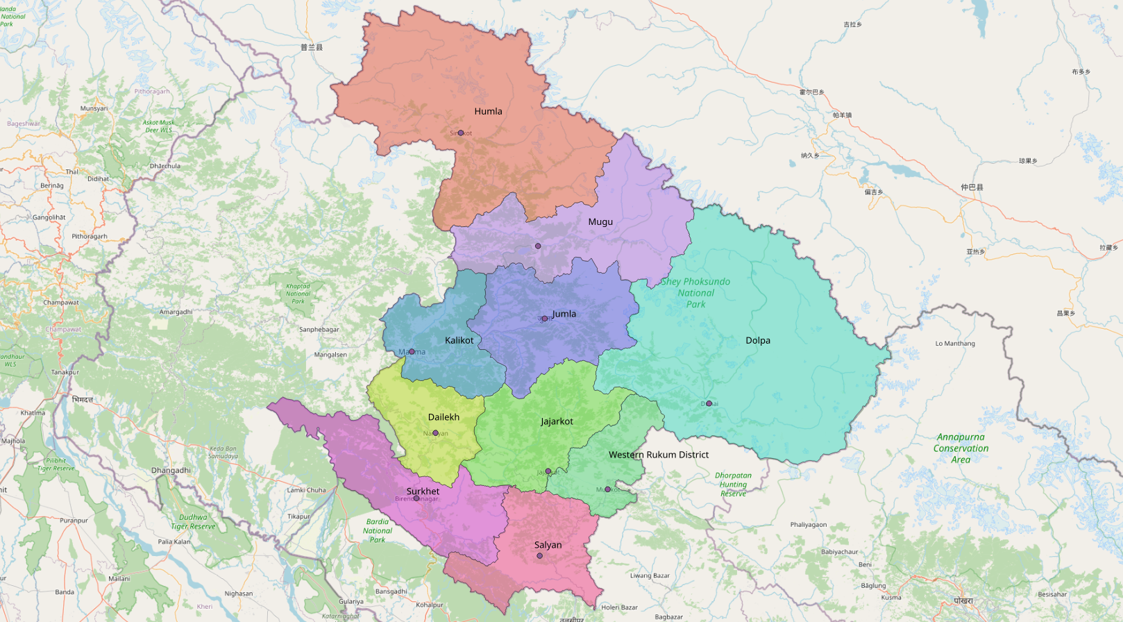
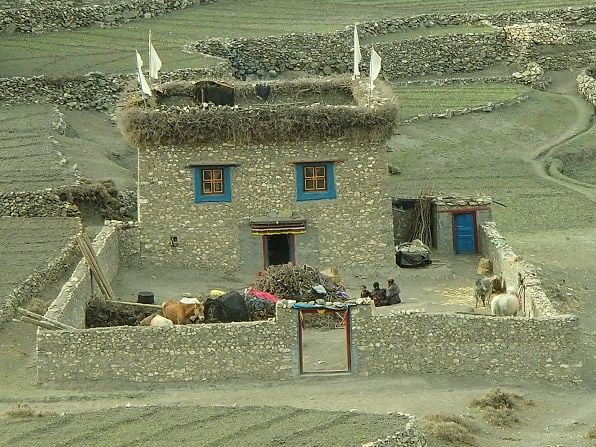
Komang village lies in the North part of the Dolpo district. Dolpo is a culturally Tibetan region located between the valleys of western Nepal (south), and the Phoksundo and Mugu Karnali Valleys (west and northwest). Almost ninety percent of the region lies above 4,500 meters. To the southwest lies Dhaulagiri, the sixth highest mountain in the world (8172 meters). This massif and its outliers create a rain shadow that determines much of Dolpo's climate. Though no meteorological records have been kept in Dolpo, its valleys probably receive less than five hundred millimeters of precipitation yearly.
Dolpo is home to some of the highest villages on earth. Komang village's altitude is 4,500 meters which makes it one of the highest permanent settlements in the region and the world.
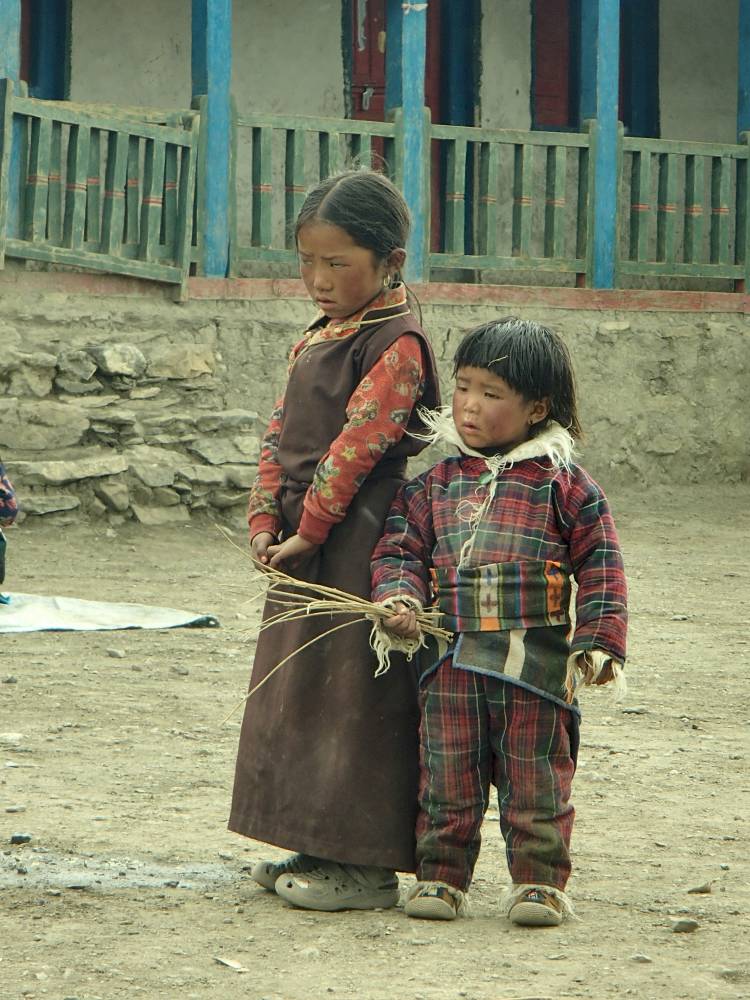
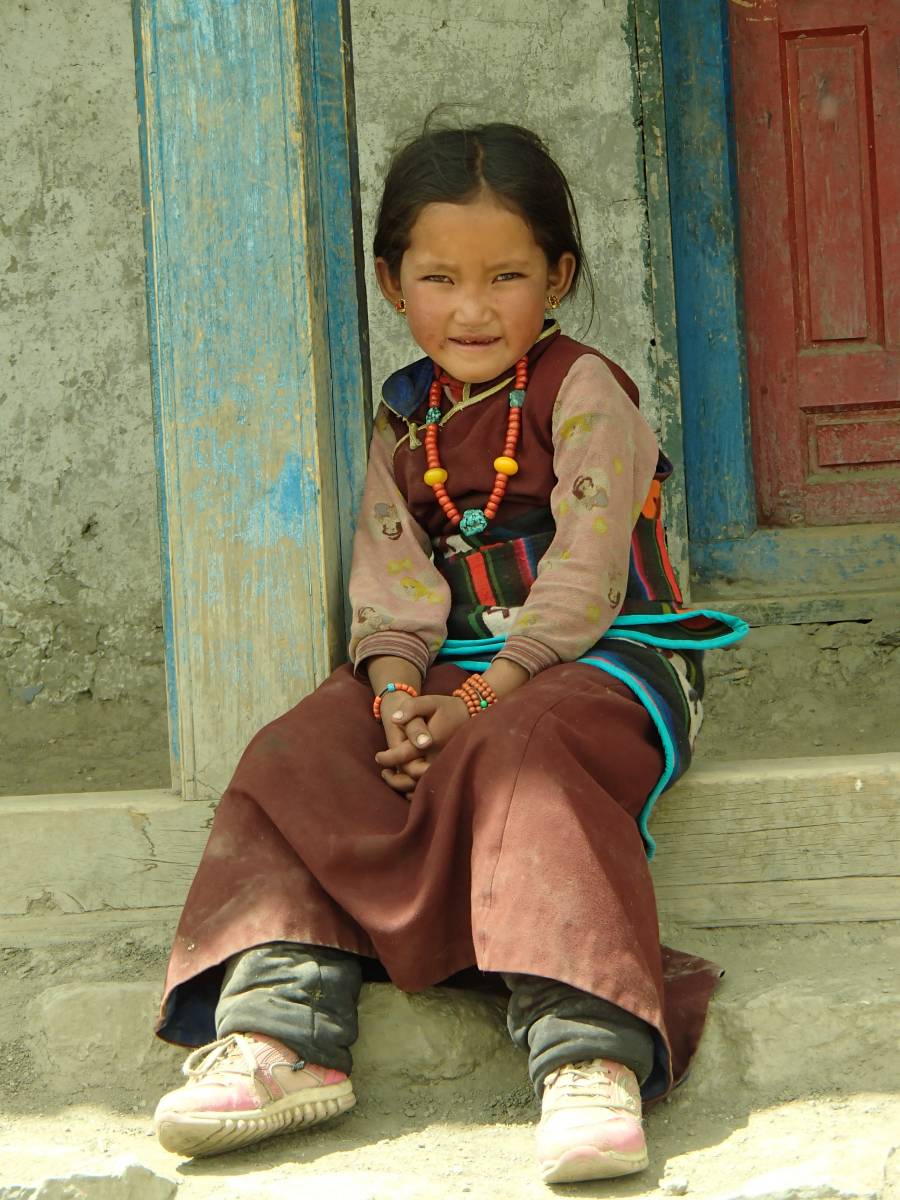
Demography and lifestyle
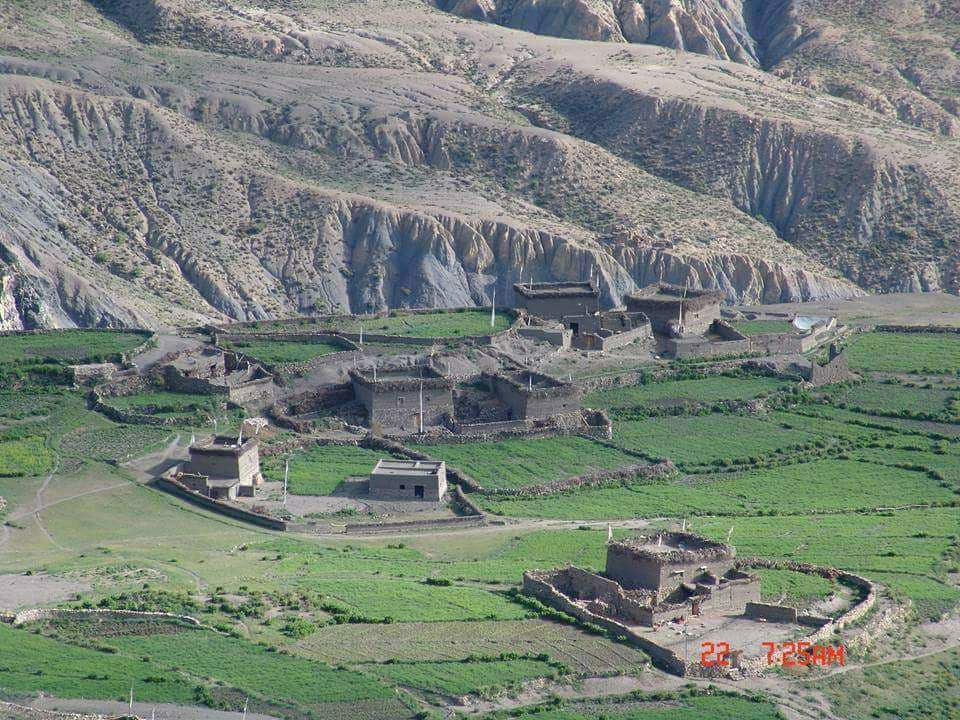
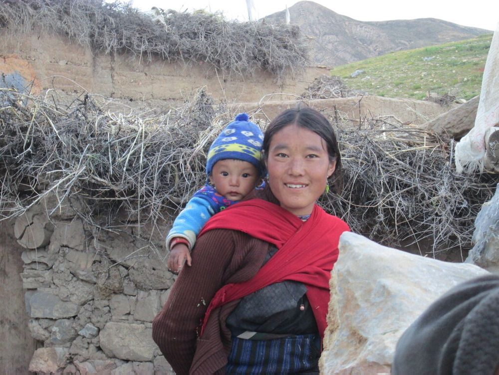
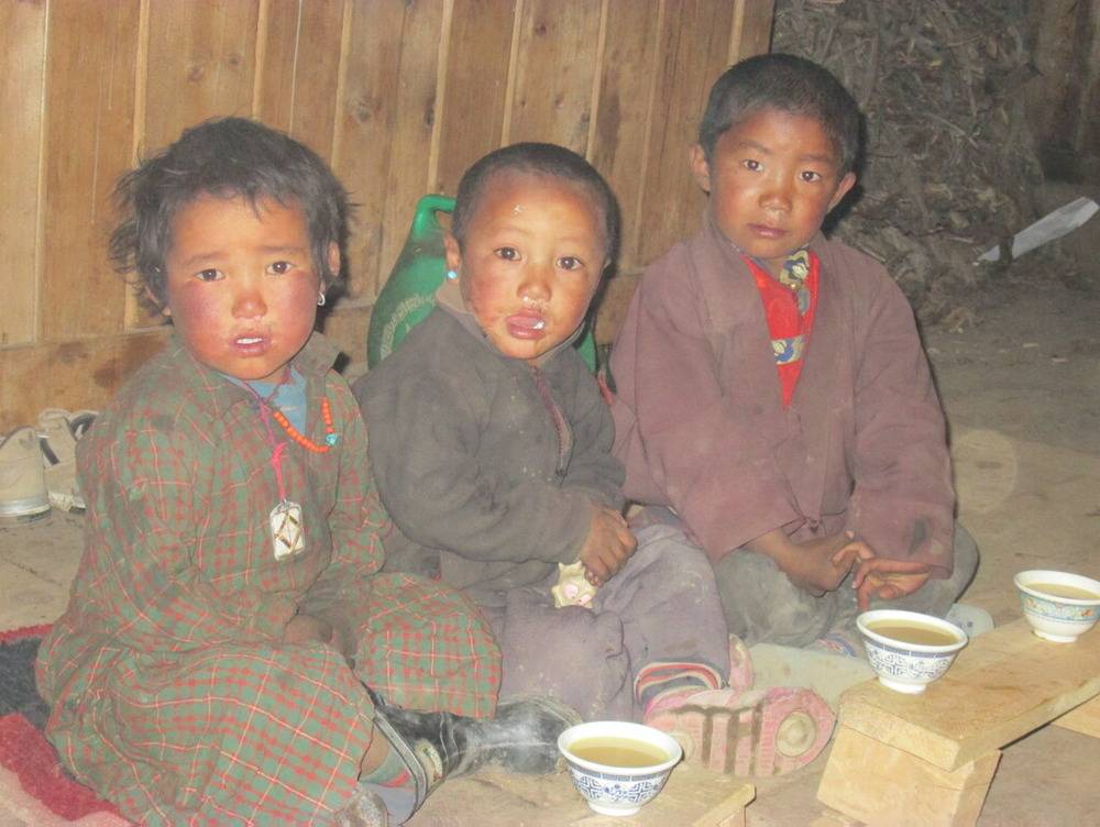
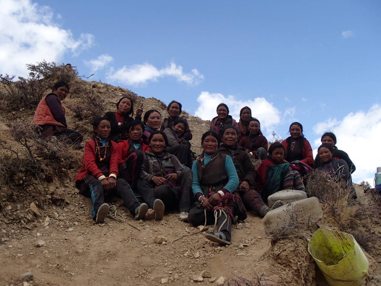
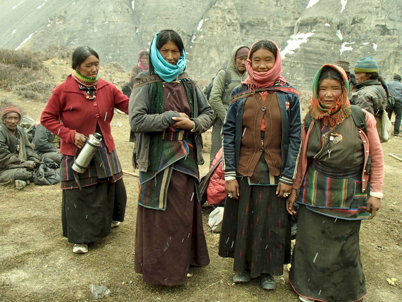
In our village, there are 52 houses and around 210 people: 80 women, 60 children, and 70 males live there. Most of the villagers can read the Tibetan alphabet and prayers, but mainly women don’t know how to write in Tibetan.
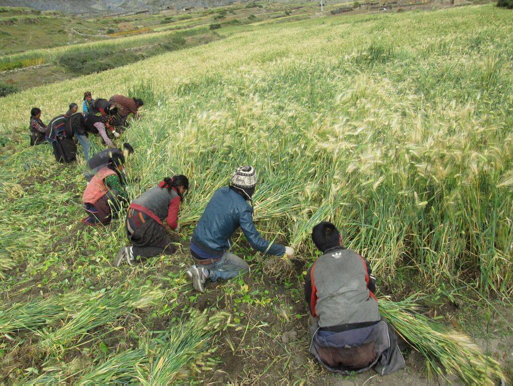
Our people wrest survival from this inhospitable landscape by combining agriculture, animal husbandry, and trade. Komang’s agro-pastoral livelihood is characterized by migrations between permanent villages and pastures at higher altitudes. More than ninety percent of the population lives under the poverty line, literacy is low, and life expectancy is a mere sixty years.
Administratively, the valleys of Komang are located in the northern reaches of Nepal's largest district, Dolpa. This region is also referred to as 'Upper' Dolpo by His Majesty's Government of Nepal, a designation that has restricted foreigners from traveling extensively in this area.
Meaning of Komang name
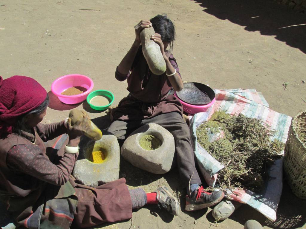
The history of Komang village we know is that the village's structure symbolizes an Elephant and the name itself symbolizes a plant called Koma plant”. The Koma plant is maroon color outside and white inside but the inside color becomes light red-pinkish when we use it. We use the Koma plant for dharma rituals, to make hair smooth, etc. Our village's name, “Ko” refers to the Koma plant and “Mang” means many. Therefore Komang village is recognized as “the place where we get many koma plants”.
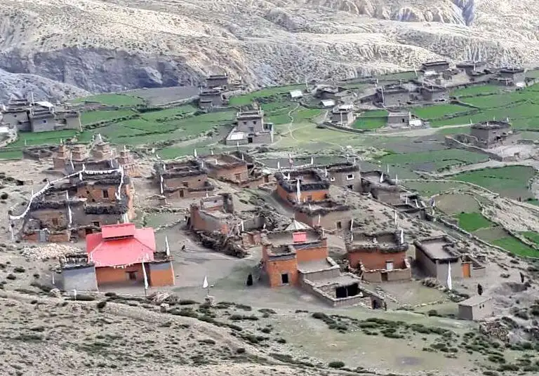
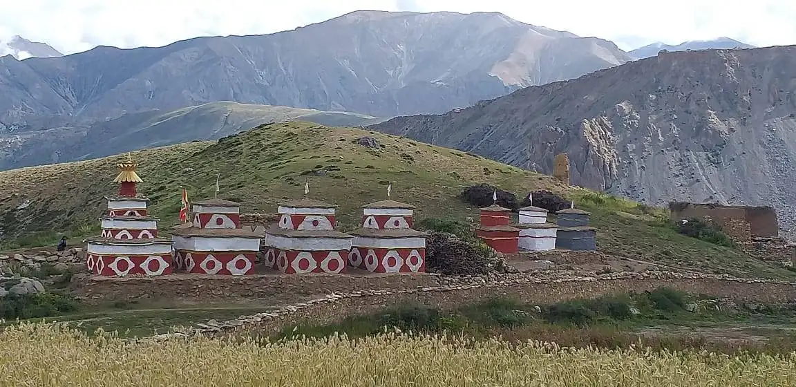
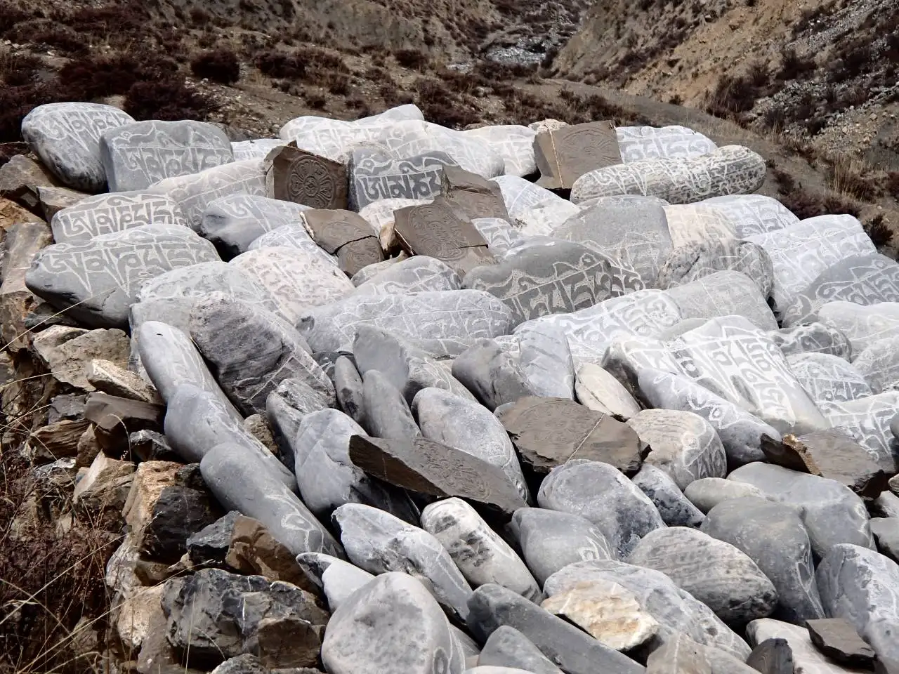
Our local deities
We have 4 local deities in Komang: They are Apo Shanak, Ama Numaa, Jhasang Choekyong and Dyahagyae Lhatsen Karpo. All of them are protectors of our village and they do protect well.
Villagers offer flags to the deities when traveling or at other events. If for some reason they cannot reach the offering spots, we have another offering place on a small hill in the middle of the village from where we can see clearly all the places of the deities.
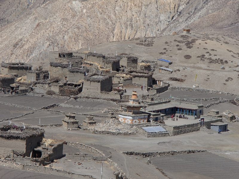
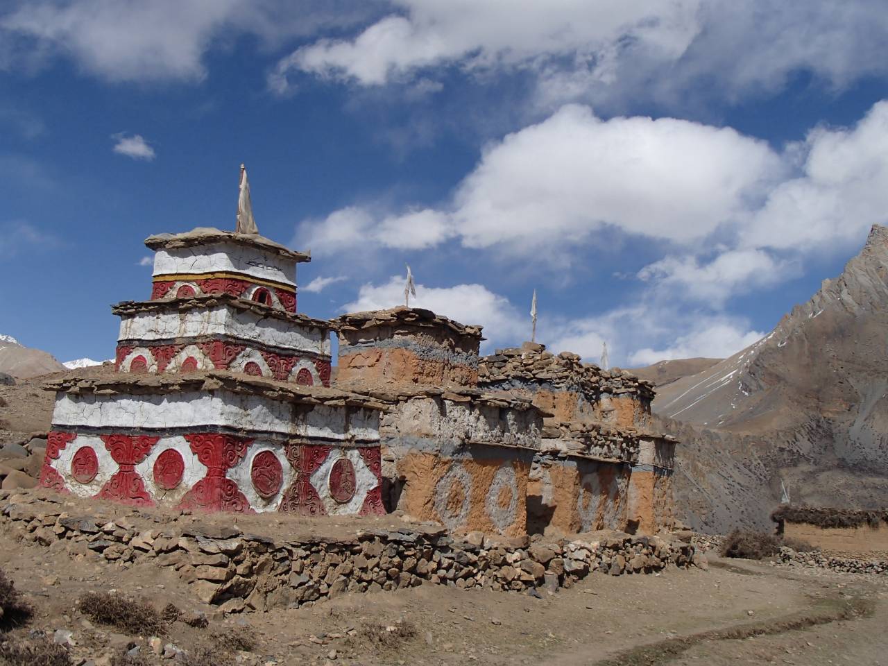
The special place of Kharak
Kharak is a special place in Komang village. Historically Kharak has a great significance for us because is the place where many great Rinpoches (precious teachers) have been born. Up to this day, a total of 11 great Rinpoches have been born in Kharak for 11 generations, the last one being the current Komang Rinpoche.
Many years ago, this area became semi-abandoned with just a broken house where goats, sheep, and other animals use to roam. Finally, it became empty and Rinpoche decided to build a monastery there called “Kharak Dekyid Phodangling Monastery”.
Before the creation of Komang village primary school, most of the children used to come to Kharak Dekyid monastery for about 4 months to receive some basic education from Rinpoche and his uncle Amchi-la Karma Lundhup.
Himalayan Dolpo Region
Dolpo (Nepali. Dolpa) is the biggest district of Nepal. It is in the western province of Karnali which is also the biggest of the seven provinces of Nepal. Geographically lies in the northwest of the country, on the border with Tibet. Even though it is the largest district in the area, it is very sparsely inhabited and has a population of around 30,000.
In the northern part of the district, in one of the highest inhabited regions of the world, mostly over 3000 meters above sea level, lives a Tibetan-speaking population who call themselves Dolpo-pa (person from Dolpo).
Dolpo can be roughly divided into four valleys, each of which is represented since 1975 by a village development committee (VDC): Dho (Tarap Valley), Saldang (Nankhong Valley, the most populous), Tinje (Panzang Valley), and Chharka (Tsharka Valley). There are also smaller VDCs at Bhijer, Mukot, and Phoksundo. Komang village belongs to Saldang valley and VDC in Upper Dolpo.

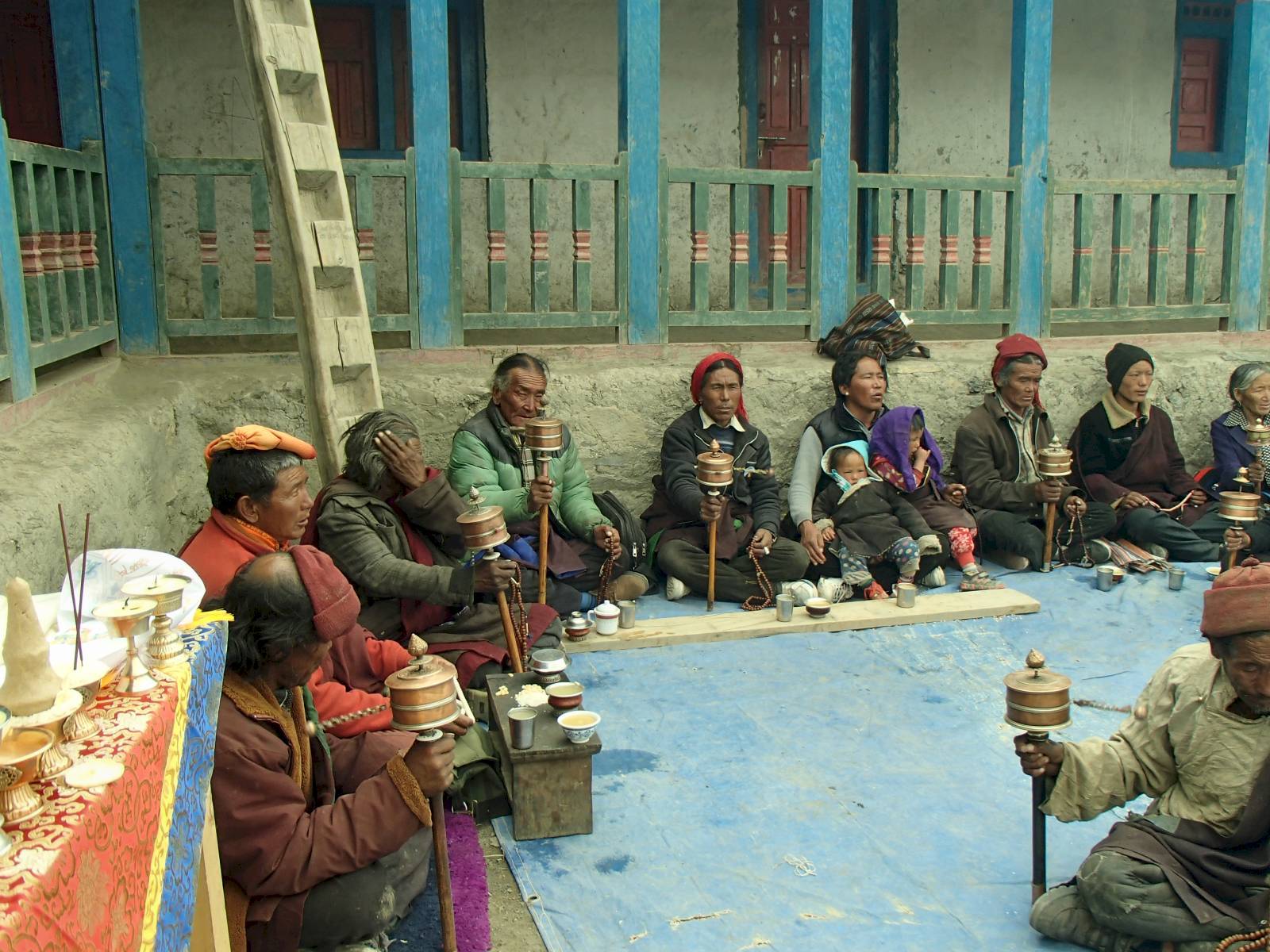
Culture and religion
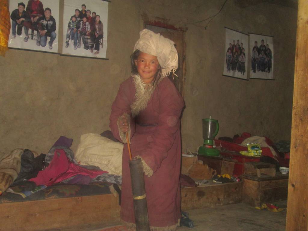
The district is divided into two regions Upper and Lower Dolpo. The upper region is inhabited by the Tibetan-speaking people who arrived from Tibet around the 8th century escaping wars between kingdoms. They practice Buddhist and Bon religions and are very connected to Tibet through trade. Lower Dolpo is lower altitude and more populated, the predominant ethnicity and culture are Nepali people who practice Hinduism often influenced by Bon and Buddhism. Most people in Lower Dolpo speak the Nepali language and dress in the traditional Nepali style.
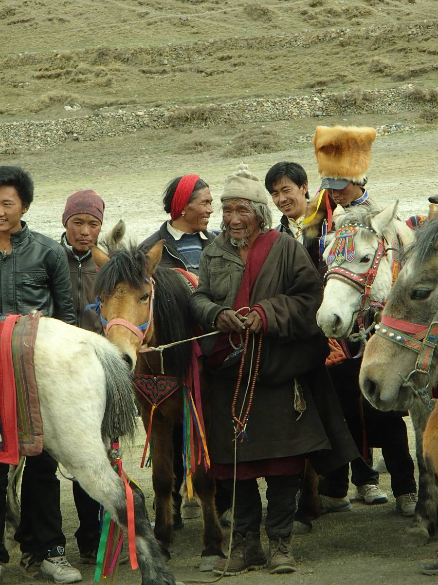
Upper Dolpo lifestyle
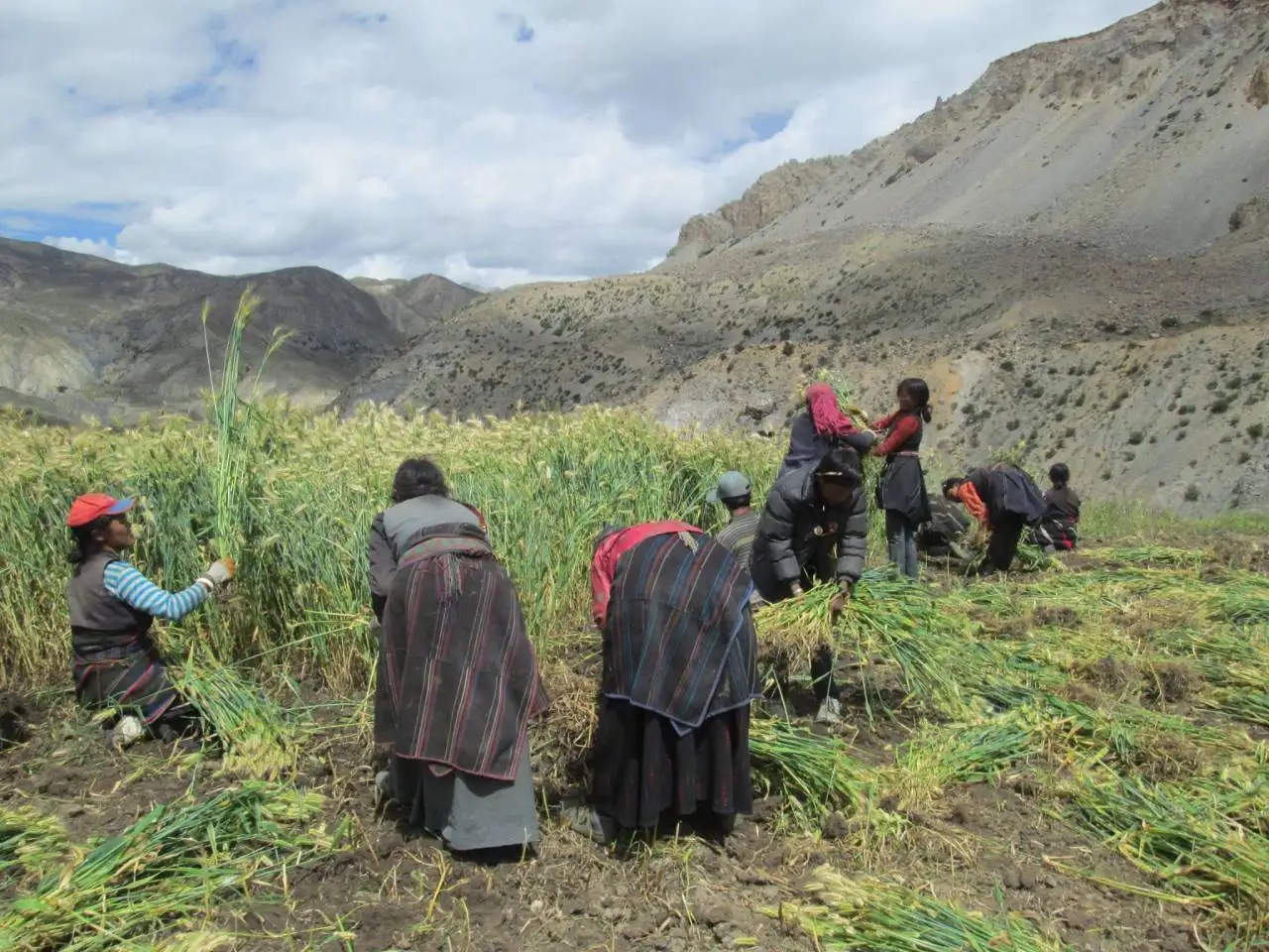
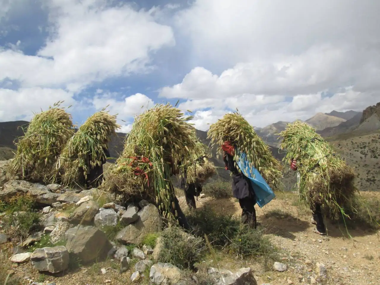
Agriculture is possible at heights of 3,800 to 4,180 meters (12,470 to 13,710 ft) (villages of Shimen Panzang Valley and Chharka, respectively) but often requires irrigation. Apart from barley, crops include buckwheat, millet, mustard, wheat, potatoes, radishes, and spinach.
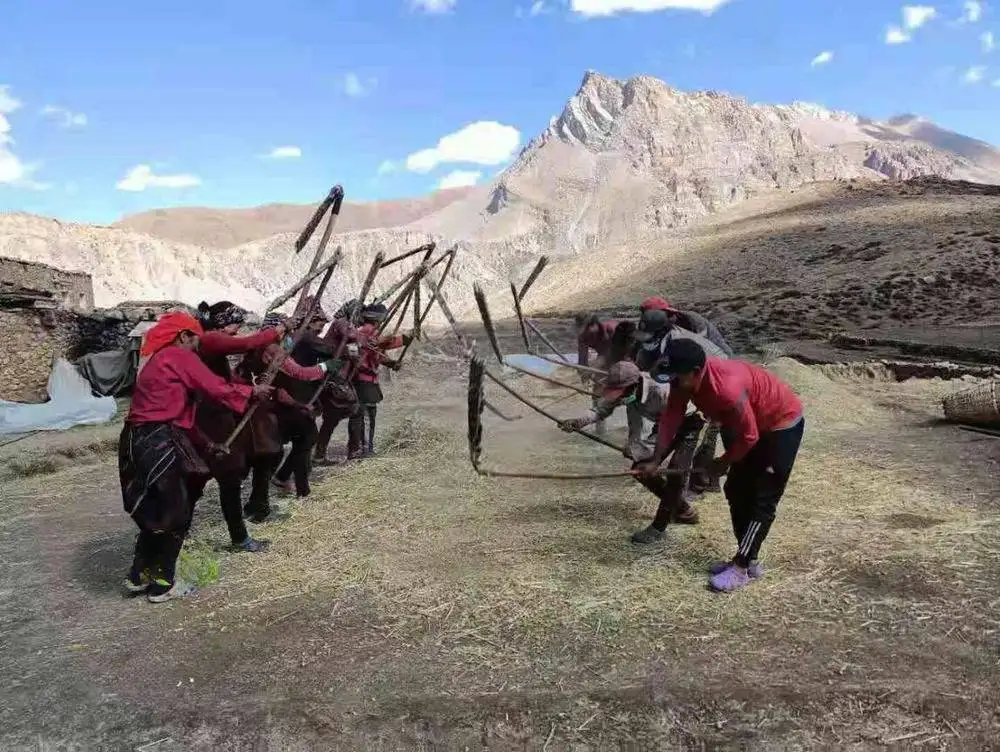
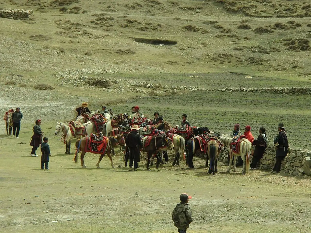
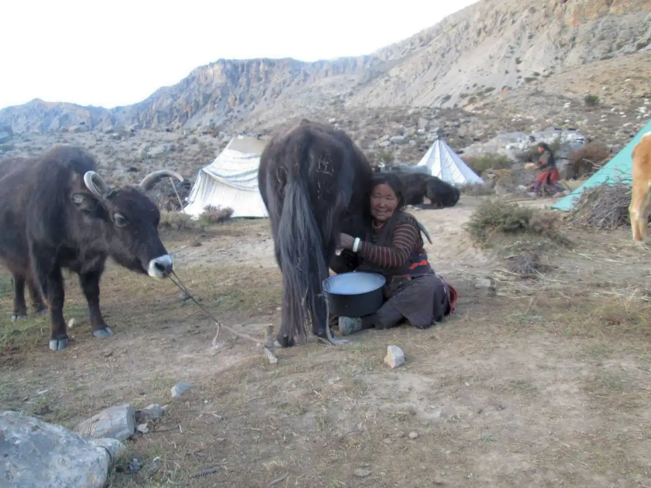
As agriculture and animal husbandry does not suffice in this barren region, the inhabitants rely on trade to get access to additional goods. In summer the men trek to Tibet with their yak caravans, while the women live in the upland pastures with the female animals (the dri) and produce butter and cheese.
In Tibet crop is exchanged for tea, salt, wool, butter as well as modern commodities. In spring and autumn, the acquired goods are then again traded in southern Dolpo or even in Jumla. In the winter the people leave their main villages and move to their winter villages, or, those who can afford it, go on a pilgrimage to Kathmandu.